Category Archives: AFRICA

A 30-Foot-Long Hidden Corridor was discovered in the 4,500-year-old Great Pyramid of Giza!

A 30-Foot-Long Hidden Corridor was discovered in the 4,500-year-old Great Pyramid of Giza!

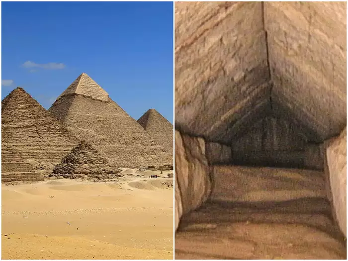
A 30-foot-long hidden corridor was discovered on March 2, 2023, in the Great Pyramid of Giza. This monument is the last standing Ancient Wonder of the World. This North Facing Corridor (NFC) is the first discovery uncovered on the monument’s north side.

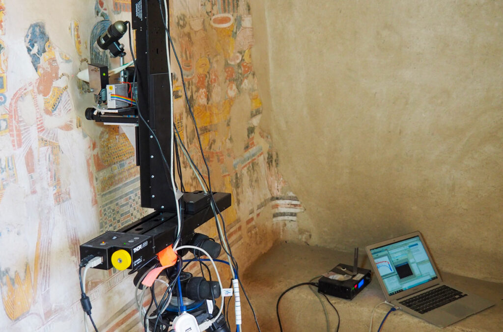
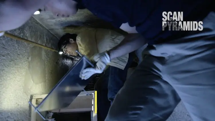
The corridor is located above the ancient entrance of the pyramid, behind a chevron-shaped structure that is visible outside the pyramid. This fascinating discovery within the pyramid was made under the ScanPyramids project using muon tomography, a non-invasive technology.

The ScanPyramids Project – An Initiative to Uncover the Hidden Secrets in the Pyramids

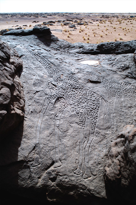
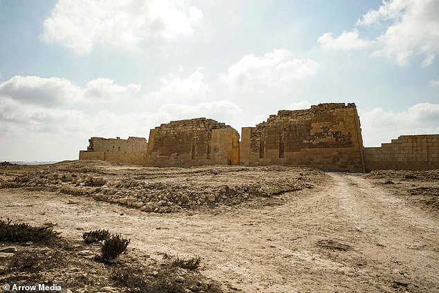
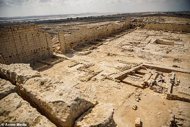
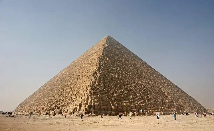
The Great Pyramid was constructed around 2560 BCE during the reign of Pharaoh Khufu. The height of the monumental tomb was around 146 meters when it was constructed. But it now stands at 139 meters with much of its limestone casing removed.

The pyramid consists of an elaborate system of passageways and chambers. However, not all of them have been uncovered yet.

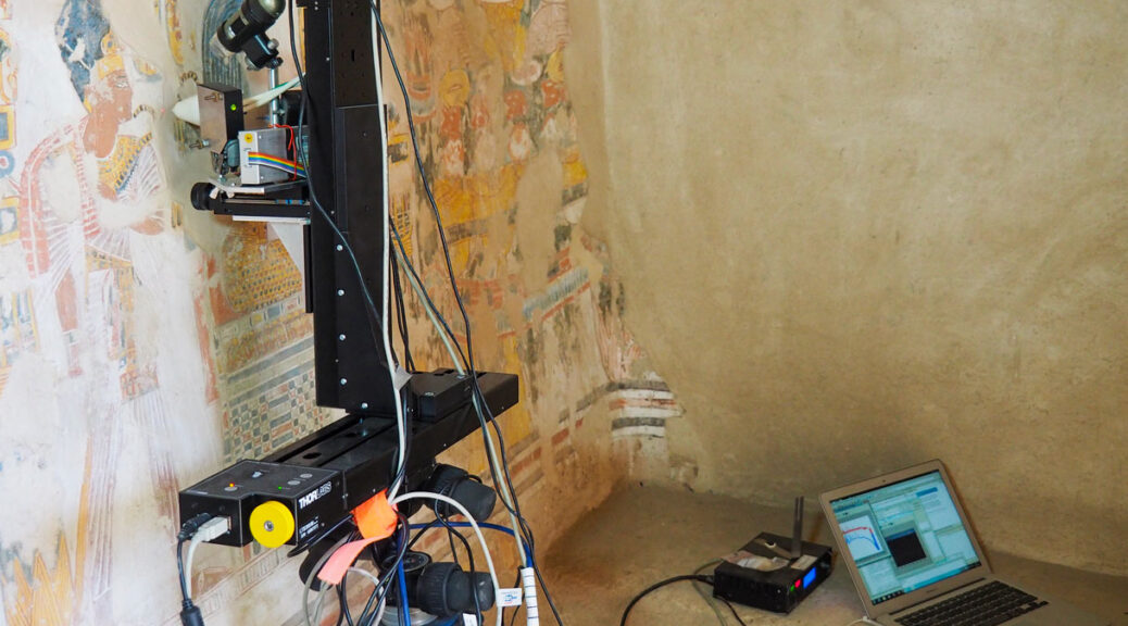
In order to detect the presence of unknown voids and structures without excavating, the ScanPyramids project was launched in 2015. This Egyptian-international project is designed and led by Cairo University and the French HIP Institute (Heritage Innovation Preservation). The project combines several non-invasive and non-destructive techniques, such as 3D simulations, infrared thermography, muon tomography, and other reconstruction techniques, to scan the structure.

The 30-Foot Long Hidden Corridor Was Discovered Using Non-Invasive Technology.

Telescope installed inside the Great Pyramid of Giza.

As part of the ScanPyramids project, the most recent discovery is a 30-foot-long hidden corridor in the Great Pyramid of Giza. Egyptian antiquities officials confirmed its discovery on March 2, 2023.

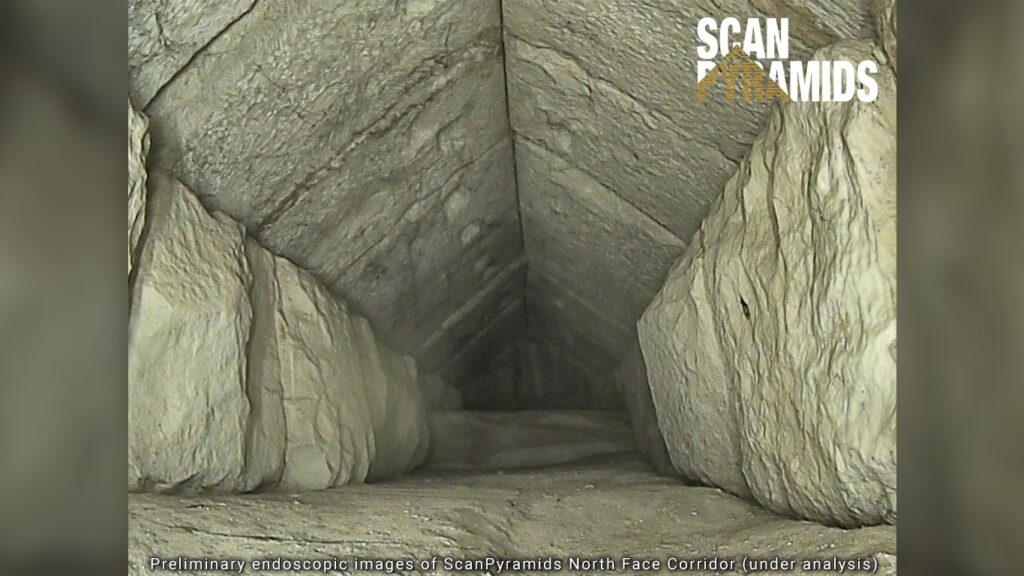
The corridor was detected using muon tomography, a non-invasive technology that uses cosmic ray muons to generate three-dimensional images of objects. In order to retrieve images of what lies within, researchers inserted an endoscope into a tiny joint in the pyramid stones. However, no artifacts were visible in the captured images.

Mostafa Waziri, head of Egypt’s Supreme Council of Antiquities, said that the hidden corridor might have been constructed to redistribute the weight within the massive monument. In fact, in another part of the pyramid, there are five rooms atop the King’s Burial Chamber, which are thought to have been built to redistribute the weight of the massive structure. Waziri also added that they would continue scanning to figure out what is underneath the chamber at the end of the corridor.

Installing muon emulsion films.

Scientists also believe that structural innovations constructed by the Egyptian tomb builders were mostly for pragmatic reasons rather than storing any hidden treasure. For example, the discovered hidden corridor could be related to the construction of the chevron as a first test of the structure before it was used later, higher up in the pyramid. Therefore, there is little likelihood anything major or valuable will be found inside these chambers.

An article published in the Nature Communications journal said that the discovery of this hidden corridor could help in gaining knowledge about the structure and techniques used in the construction of the pyramid. In addition, it could also help in understanding the purpose of the gabled limestone structure that sits in front of the corridor.

Furthermore, Egyptian antiquities officials believe that this amazing discovery could serve as a catalyst for conducting further research in other mysterious inner chambers.

Other Extraordinary Discoveries of the ScanPyramids Project

The great pyramid of Giza.

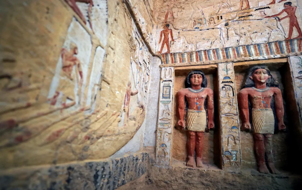
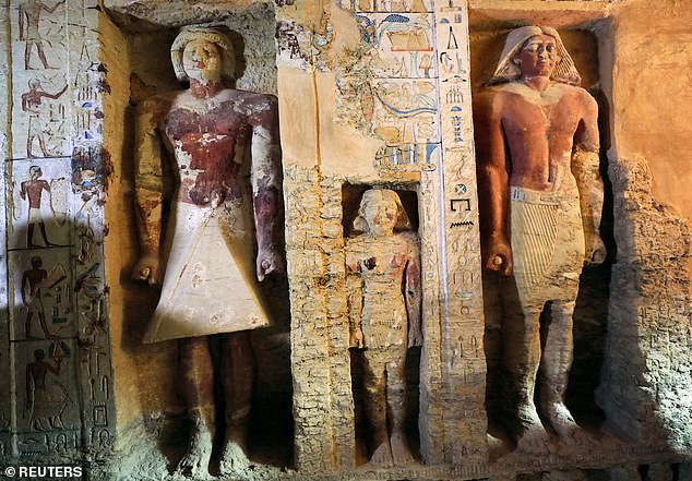
The ScanPyramids project has led to many other astonishing discoveries in the past. In 2016, researchers discovered a void behind the north face of the Great Pyramid. Following this, in 2017, they discovered a bigger “plane-sized” void, around 98 feet long, above the Grand Gallery.

Thus, we can conclude that even though the tomb commissioned by Pharaoh Khufu has been explored for years together, there are many more mysteries yet to be unraveled.

Scientists plan to continue these non-invasive scans at the Great Pyramid of Giza to uncover more hidden secrets as part of the ScanPyramids project. They also plan to use sophisticated muon detectors to detect the presence of artifacts, if any

This ancient weapon was made from an object that fell out of the sky

This ancient weapon was made from an object that fell out of the sky

An exceedingly small artifact crafted from an iron alloy that fell from the sky was retrieved near a settlement. It was not the closest meteorite to the area, however, researchers think it may have originated from Estonia, which is a considerable distance away.

This ancient weapon was made from an object that fell out of the sky
The unassuming arrowhead was found to be made from a meteorite.

The arrowhead is not only indicative of the use of sky iron in the pre-smelting era, but it also reveals the existence of vast trading systems which operated thousands of years ago.

Geologist Beda Hofmann of the Natural History Museum of Bern and the University of Bern in Switzerland initiated an extensive search to find ancient meteoritic iron artifacts.

As pure iron was a rarity in ancient times, the only readily available option was to use the iron that had fallen from the sky in the form of meteorites.

Iron meteorites are the type that are most commonly seen. They can survive the impact of entering the atmosphere and are generally composed of iron, as well as small amounts of nickel and minuscule amounts of other metals. It is believed that most iron tools and weapons used during the Bronze Age were created using meteoritic iron.

Throughout the Middle East, Egypt, and Asia, numerous artifacts have been discovered; however, there have been vastly fewer finds across Europe.

Morigen, located in present-day Switzerland, was a thriving settlement during the Bronze Age, from approximately 800 to 900 BCE.

The Twannberg field, which contains remnants of a rock that arrived from the heavens a great many years prior to the last ice age, was only a short distance from Morigen (no more than 8 kilometers, or 5 miles) according to the Harvard University abstract.

Hofmann and his crew uncovered an iron arrowhead from the site that they had already excavated. It was 39.3 mm long and weighed 2.904 grams. The team noticed that organic residue was present, which they assumed was birch tar, likely used to attach the arrowhead to its shaft. Its composition was out of this world.

Analysis of the object has confirmed the presence of iron and nickel, which is the usual makeup of meteoritic iron. Additionally, a radioactive isotope of aluminum – aluminum-26 – was found, which can only be created in space, among the stars.

The X-ray sections of the arrowhead are depicted in the image above. The areas signifying the highest density and brightness are identified as iron.

It’s quite interesting to note that the combination of metals present in the arrowhead doesn’t match the iron found in Twannberg. Rather, it appears to be a type of iron meteorite known as an IAB meteorite.

The origin of the arrowhead is easier to identify considering the large IAB meteorites known to have crashed in Europe.

Three of these have a composition that coincides with the arrowhead: Bohumilitz from Czechia, Retuerte de Bullaque from Spain, and Kaalijarv from Estonia. These meteorites are documented on the websites of the Lunar and Planetary Institute.

The researchers concluded that Kaalijarv most likely matched the description. It had arrived on Earth near 1500 BCE and the pieces it created were suitable for forging into arrowheads. However, its location was 1600 km (994 miles) away from Morigen, indicating that it had possibly traveled via the Amber Road.

Considering the vast amount of meteorite debris created by the Kaalijarv impacts, it would be beneficial to survey through collections for items corresponding to the arrowhead, in an effort to discover the parent meteorite.

The researchers state that although it may have originated from Kaalijarv, it is highly probable that the arrowhead was not an isolated object and that there may be other worked fragments of meteoritic iron, such as those of miniature size, in archaeological collections around Europe and possibly even further.

The study was originally published in the journal Science Direct on July 25, 2023.

Rock art of a Giraffe dabous niger dated at Approximately 9,000 years ago

Rock art of a Giraffe dabous niger dated at Approximately 9,000 years ago

Giraffes with their long necks and lanky gait have captivated humans for thousands of years. Rock carvings in the Sahara Desert in northern Niger, estimated to be 9,000 years old, represent the earliest recorded human association with a giraffe.

The Dabous giraffes, located north of Agadez in Niger, are some of the most striking examples of Saharan rock art known. It is not known who carved the figures, but they may have been created by the Tuareg people.

Rock engravings spanning several thousands of years are common in the Dabous area; over 300 are known, varying in size from quite small to the life-sized depictions shown here.

Probably dating to c.5000 – 3000 BC, each giraffe is engraved into a gently sloping rock face, the choice of location possibly a deliberate attempt to capture the slanting rays of the sun so that the shallow engravings were visible at certain times of the day; human figures representing local hunter-gatherers are drawn to scale below the giraffes. The naturalism, perspective, and attention to detail are striking.

Africa’s climate was much wetter during the period in which the engravings were made than it is at present, and the Saharan region was verdant grassland that supported rich wildlife.

Other examples of broadly contemporary rock art in the region depict elephants, gazelles, zebu cattle, crocodiles, and other large animals of the grasslands, although giraffes appear to have been especially important to regional hunter-gatherer groups. 

Under the auspices of UNESCO, the Bradshaw Foundation was tasked with coordinating the Dabous preservation project, in association with the Trust for African Rock Art. The preservation project was to involve taking a mould of the carvings from which to create a limited edition of aluminium casts, one of which would be gifted to the town of Agadez near the archaeological site, another of which would be located at the National Geographic headquarters in Washington D.C.

A further element of the preservation project was to sink a water well in the area in order to support a small Tuareg community who would be responsible for guiding tourists at the Dabous site. In the heart of the Sahara lies the Tenere Desert. ‘Tenere’, literally translated as ‘where there is nothing’, is a barren desert landscape stretching for thousands of miles, but this literal translation belies its ancient significance – for over two millennia, the Tuareg operated the trans-Saharan caravan trade route connecting the great cities on the southern edge of the Sahara via five desert trade routes to the northern coast of Africa.

One of the finest examples of ancient rock art in the world – two life-size giraffe carved in stone

Dabous Giraffe Rock Art Petroglyph one of the finest examples of ancient rock art in the world – two life-size giraffe carved in stone and before the Tuareg? Life in the region now known as the Sahara has evolved for millennia, in varying forms.

One particular piece of evidence of this age-old occupation can be found at the pinnacle of a lonely rocky outcrop. Here, where the desert meets the slopes of the Air Mountains, lies Dabous, home to one of the finest examples of ancient rock art in the world – two life-size giraffe carved in stone.

They were first recorded as recently as 1987 by Christian Dupuy. A subsequent field trip organised by David Coulson of the Trust for African Rock Art brought the attention of archaeologist Dr Jean Clottes, who was startled by their significance, due to the size, beauty and technique.

The two giraffe, one large male in front of a smaller female, were engraved side by side on the sandstone’s weathered surface. The larger of the two is over 18 feet tall, combining several techniques including scraping, smoothing, and deep engraving of the outlines. However, signs of deterioration were clearly evident.

Despite their remoteness, the site was beginning to receive more and more attention, as these exceptional carvings were beginning to suffer the consequences of both voluntary and involuntary human degradation. The petroglyphs were being damaged by trampling, but perhaps worse than this, they were being degraded by Grafitti, and fragments were being stolen.

The obvious answer to was to preserve the giraffe carvings because of their artistic significance, but also their placement within a palaeo-African contexts Chairman of the Bradshaw Foundation, Damon de Laszlo, saw that ‘the obvious answer to this was to attempt to preserve them, not only because of their artistic significance, but also their placement within a palaeo-African context ie. a greener Sahara, and how this ties in with our ‘Journey of Mankind’ Genetic Map.’

Damon de Laszlo: The obvious answer was to preserve the giraffe carvings because of their artistic significance, but also their placement within a palaeo-African context

This preservation would take the form of making a mould of the carvings and then casting them in a resistant material. The point of this was two-fold; now was the time to take the mould because the carvings were still – just – in perfect condition, and by publicising the importance of the carvings, their value would be realized and their protection prioritized.

By chance, a year earlier saw the publication of ‘Zarafa’ by Michael Allin, depicting the fascinating tale of a giraffe from Sudan being led across France in 1826 – the Dabous giraffe would travel to France nearly two hundred years later but in a slightly different fashion.

One of the major aims of the Bradshaw Foundation is to preserve ancient rock art, but with a project of this nature and scale, we obviously needed permission from both UNESCO and the government of Niger.

Moreover, it was important to ensure that the project would be carried out at the grass-roots level, with the full involvement of the Tuareg custodians. Finally, consideration of the future preservation had to be catered for, and for this reason, a well was sunk near the site to provide water for a small group to live in the area, a member of which would act as a permanent guide – to show where to mount the outcrop, where to best view the petroglyphs without walking on them, and to ensure no damage or theft.

Lost Egyptian City Found Underwater After 1200 Years

Lost Egyptian City Found Underwater After 1200 Years

The ‘lost city of Atlantis has eluded explorers for centuries and is almost certainly the stuff of myth. Staggeringly, though, an ancient city that is Atlantis in all but name has emerged from under the sea near Alexandria — and now the lost world of Heracleion is giving up its treasures.

Just as in the classical tale, Heracleion was once a prosperous, thriving city before it was engulfed by the sea around 1,500 years ago. It was grand enough to be mentioned by the Greek writer Herodotus, the 5th-century BC historian.

He told the fabulous story of Helen of Troy, the most beautiful woman in the world — she of the face that launched a thousand ships — travelling to Heracleion, then a port of ‘great wealth’, with her glamorous Trojan lover, Paris.

Franck Goddio and divers from his team inspect the statue of a pharaoh
Among the most important monuments that were discovered at the temple area of Thonis-Heracleion is this monolithic chapel dating to the Ptolemaic period

But no physical evidence of such a grand settlement appeared until 2001 when a group led by French marine archaeologist Franck Goddio stumbled upon some relics that led them to one of the greatest finds of the 21st century.

Goddio was in search of Napoleon’s warships from the 1798 Battle of the Nile, when he was defeated by Nelson in these very waters, but came upon this much more significant discovery.

Goddio’s team has since been joined by the Oxford Centre for Maritime Archaeology and the Department of Antiquities of Egypt to produce a wealth of dazzling finds.

The archaeologists first faced the mammoth task of reassembling massive stone fragments on the seabed before they could haul them to the surface. Twelve years on, their fabulous finds have been exposed to public view for the first time after more than a millennium spent beneath the silt and water of Aboukir Bay, 20 miles northeast of Alexandria.

Among the discoveries are colossal statues of the Egyptian goddess Isis, the god Hapi, and an unidentified Egyptian pharaoh — all preserved in immaculate condition by their muddy burial shroud. Along with these 16ft statues, there are hundreds of smaller statues of Egyptian gods — among them the figures that guarded the temple where Cleopatra was inaugurated as Queen of the Nile.

It seems the Amun-Gereb temple at Heracleion was the Egyptian equivalent of Westminster Abbey, where our own Queen was crowned 60 years ago.

Dozens of sarcophagi have been found, containing the bodies of mummified animals sacrificed to Amun-Gereb, the supreme god of the Egyptians. Many amulets, or religious charms, have been unearthed, too, showing gods such as Isis, Osiris and Horus.

These were made not just for the Egyptians but for visiting traders, who incorporated them into their own religions and also, one imagines, kept them as trinkets to remind them of their far-flung journeys.

The importance of Heracleion has been further proved by the discovery of 64 ships — the largest number of ancient vessels ever found in one place — and a mind-boggling 700 anchors.

Other finds illustrate how crucial Heracleion was to the economy of the ancient world. Gold coins and lead, bronze and stone weights from Athens (used to measure the value of goods and to calculate the tax owed) show that Heracleion was a lucrative Mediterranean trading post.

An archaeologist measures the feet of a colossal red granite statue at the site of Heracleion discovered in Aboukir Bay
The statue of the Goddess Isis sits on display on a barge in an Alexandrian naval base (left). Pictured right is a colossal statue of red granite representing the god Hapi, which decorated the temple of Heracleion
An international team of marine archaeologists is preparing to show some of the objects found in the underwater city
Heracleion was mentioned by the Greek historian Herodotus, who told of Helen of Troy visiting the city with her lover Paris before the Trojan war

In the ancient world, the Mediterranean Sea was their equivalent of a superfast motorway. All their greatest cities, including Constantinople, Rome and Athens, were either on the coast or on rivers with easy access to it.

And now Heracleion can be added to their number as Egypt’s most important port during the time of the later pharaohs. It was, if you like, a major motorway junction — the spot where the Nile, Egypt’s lifeline, met the Med. Archaeologists have determined that as well as having a naturally navigable channel next to its ancient harbour, a further artificial channel appears to have been dug to expedite trade.

The Heracleion finds will add tremendous depth to our understanding of the ancient world — not least because, among the discoveries, there are perfectly preserved steles (inscribed pillars) decorated with hieroglyphics. Translated, they will reveal much about the religious and political life in this corner of ancient Egypt.

It was a similar inscription on the Rosetta Stone — discovered in the Nile Delta town of Rosetta in 1799 by a French soldier, and now in the British Museum — that cracked the code of hieroglyphics in the first place.

And like the Rosetta Stone, those steles found beneath the waters of Aboukir Bay are inscribed in Greek and Egyptian, too. Who knows how many more archaeological gems will be uncovered at Heracleion?

The very name of the city is taken from the most famous of Greek heroes, Heracles — aka Hercules — whose 12 labours, from killing the  Hydra to capturing Cerberus, the multi-headed hellhound that guarded the gates of the Underworld, captivated the ancient world.

Heraklion, Crete’s capital and largest city, is also named after Heracles, as was Herculaneum, the ancient Roman town that was buried under ash when Vesuvius erupted in 79 AD. It appears that Heracleion faded in importance in the later classical period, eclipsed by its neighbouring city of Alexandria, which became the capital of Egypt in 312 BC.

Still, Heracleion lingered on, later under Roman control, until it slipped into its watery grave sometime in the 6th or 7th century AD. What a thrilling discovery we have on our hands now that the sea has, 1,500 years later, given up one of its greatest secrets.

The ancient port city lies 20 miles northeast of Alexandria in the Mediterranean

Mystery behind Cleopatra’s tomb: Two mummies discovered in Egypt could help solve it

Mystery behind Cleopatra’s tomb: Two mummies discovered in Egypt could help solve it

The mummies of two high-status ancient Egyptians discovered in a temple on the Nile delta may bring researchers a step closer to finding the remains of Cleopatra, the legendary Egyptian queen.

The mummies, which had lain undisturbed for 2,000 years, are in a poor state of preservation because water had seeped into the tomb, according to the Guardian. 

But they were originally covered with gold leaf – a luxury reserved for only the top members of society’s elite – meaning they may have personally interacted with Cleopatra.  

The male and female mummies may have been priests who played a key role in maintaining the power of the legendary Egyptian queen and her lover, Mark Anthony.

Also found at the site were 200 coins bearing Cleopatra’s name and her face, which would have been pressed based on Cleopatra’s direct instructions.  The location of the long-lost tomb of Mark Antony and Cleopatra VII from the year 30 BC remains unknown, although it’s somewhere near the Egyptian city of Alexandria.   

But this research team are convinced excavations at the ancient city of Taposiris Magna, which is marked by a temple that still stands today, will soon uncover the ancient couple’s resting place.  Despite the fact researchers have been excavating the site since 2005, only a tiny percentage of the vast site has been explored. 

Mystery behind Cleopatra's tomb: Two mummies discovered in Egypt could help solve it
The two mummies found inside a sealed tomb at Taposiris Magna, where digs are ungoing to oncover the grave of Cleopatra
The temple is located near Alexandria, the capital of ancient Egypt and where Cleopatra killed herself in 30 BC

The mummies were found in what is the first ever intact tomb to be opened at Taposiris Magna – an event that’s the subject of a Channel 5 documentary to be broadcast this week. 

‘Although now covered in dust from 2,000 years underground, at the time these mummies would have been spectacular,’ Dr Glenn Godenho, a senior lecturer in Egyptology at Liverpool University, told the Guardian. 

‘To be covered in gold leaf shows they would have been important members of society.’ 

One of the mummies was found wearing an image of a scarab, pained in gold leaf, symbolising rebirth. But the 200 coins bearing Cleopatra’s likeness links the pharaoh ruler directly to Taposiris Magna, which was founded in the third century BC. 

The ‘prominent nose and double chin’ of the queen as depicted on the coins suggest she wasn’t as conventionally beautiful as the actresses that portrayed her on screen – most memorably by Elizabeth Taylor in the 1963 film ‘Cleopatra’. 

Dr Godenho said that the tomb of Anthony and Cleopatra is expected to be a ‘way grander affair’ than this mummified couple.

‘Although we don’t know what Ptolemaic rulers’ tombs looked like because none have ever been firmly identified yet, it’s really unlikely that they’d be nondescript and indistinguishable from the burials of their subjects,’ he told MailOnline.

‘Add to that the fact that most consider the tomb of Cleopatra and Mark Antony to be in the vicinity of Alexandria rather than out here at Taposiris Magna, and all the evidence points to these not being royal mummies at all.’ 

Archaeologists searching for the tomb of Anthony and Cleopatra (pictured played by Richard Burton and Elizabeth Taylor in the 1963 film) have zeroed in on a site in northern Egypt

Dr Kathleen Martinez, an academic from the Dominican Republic, is leading the dig at the Taposiris Magna temple. After working there for over 14 years, Dr Martinez and her colleagues are more convinced than ever Cleopatra’s tomb will be found there. 

Dr Martinez is seen reacting to the opening of the newly-found mummies at Taposiris Magna in the Channel 5 documentary, which will broadcast on Thursday.  

After an initial limestone slab is removed, she says: ‘Oh my god, there are two mummies … See this wonder.’ 

Osteoarchaeologist, Dr Linda Chapon, working to conserve the two mummies found inside a sealed tomb at Taposiris Magna
Experts believe Cleopatra made plans for herself and Anthony to be buried at a temple called Taposiris Magna in order to imitate the ancient myth of Isis and Osiris

Cleopatra was Egypt’s last pharaoh and the ruler of the Ptolemaic Kingdom of Egypt, from 51 BC to 30 BC. Cleopatra and her Roman lover Mark Anthony may have been buried at the site 2,000 years ago because of her desire to imitate an ancient prophecy, Dr Martinez believes. 

During her life, which ran from 69 BC to 30 BC, Cleopatra was known both as a seductress and as a captivating personality. She famously used her charms to first seduce Julius Caesar to cement Egypt’s alliance with Rome, and then to seduce one of his successors, Mark Anthony.            

In order to fix herself and Anthony as rulers in the minds of the Egyptian people, she also worked hard to associate them with the myth of Isis and Osiris. According to the myth, Osiris was killed and hacked into pieces that were scattered across Egypt.  After finding all of the pieces and making her husband whole again, Isis was able to resurrect him for a time.

Dr Glenn Godenho and Dr Kathleen Martinez inside Taposiris Magna temple near Alexandria in Egypt
Kathleen Martinez, who is leading the dig, believes the site was strongly associated with the myth of Isis and Osiris – a myth that Cleopatra often tried to imitate during her life

Martinez believes Taposiris Magna was closely associated with the myth as the name means ‘tomb of Osiris’.

The inclusion of ‘Osiris’ could mean it was one of the places where his body was scattered in the story.  After Mark Anthony killed himself following defeat to Octavian but before her own suicide, Cleopatra put detailed plans in place for them both to be buried there, in echoes of the myth, Dr Martinez thinks. 

The temple at Taposiris Magna. The opening of the first-ever intact tomb found at Taposiris Magna will be shown on Channel 5 this week
The inside of Taposiris Magna temple, where excavation work is taking place. The temple was established between 280 and 270 BC

She previously told National Geographic: ‘Cleopatra negotiated with Octavian to allow her to bury Mark Antony in Egypt. 

‘She wanted to be buried with him because she wanted to reenact the legend of Isis and Osiris. 

‘The true meaning of the cult of Osiris is that it grants immortality. After their deaths, the gods would allow Cleopatra to live with Antony in another form of existence, so they would have eternal life together.’ 

Doubts have been cast on the theory, however, as other experts believe Cleopatra was hastily buried in Alexandria itself – the city from where she ruled Egypt until her death, believed to have been caused by snake venom. 

Buried in Sand for a Millennium: Africa’s Roman Ghost City

Buried in Sand for a Millennium: Africa’s Roman Ghost City

Buried in Sand for a Millennium: Africa’s Roman Ghost City

Got Your archeologist’s cap on? Today we invite you to touch down in Algeria and explore Timgad, a lost Roman city on the edge of the Sahara desert that remained hidden beneath the sand for nearly a thousand years.

Positively obscure compared to the international notoriety of Pompeii, this ancient city is nonetheless one of the best surviving examples of Roman town planning anywhere in the historical Empire.

No one believed the first 18th century European explorer who claimed to have found a Roman city poking out of the sand in the North African desert, and the full extent of the 50-hectare site wouldn’t be realised and excavated in its entirety until the 1950s. Rome is still well worth the visit, but it’s in Algeria that some of the most impressive Roman remains in the whole world are to be found…

Timgad photographed by Brian Brake for LIFE magazine, 1965

The first thing you might be thinking when looking at these aerial photographs is that our modern grid design for cities is not so modern after all.

Long before New York City had its “grid” street system, Timgad was designed with an orthogonal grid which is lined by a partially restored Corinthian colonnade, magnificently visible from above. And it’s the oldest of its kind in the world.

Timgad photographed by Brian Brake for LIFE magazine, 1965

Originally founded by Emperor Trajan in 100 AD and built as a retirement colony for soldiers living nearby, within a few generations of its birth, the outpost had expanded to over 10,000 residents of both Roman, African, as well as Berber descent.

Most of them would likely never even have seen Rome before, but Timgad invested heavily in high culture and Roman identity, despite being thousands of kilometers from the Italian city itself.

Timgad photographed by Brian Brake for LIFE magazine, 1965

The extension of Roman citizenship to non-Romans was a carefully planned strategy of the Empire – it knew it worked better by bringing people in than by keeping them out. In return for their loyalty, local elites were given a stake in the great and powerful Empire, and benefitted from its protection and legal system, not to mention, its modern urban amenities such as Roman bath houses, theatres, and a fancy public library…

Timgad photographed by Brian Brake for LIFE magazine, 1965

Timgad, also known as Thamugadi in old Berber, is home to a very rare example of a surviving public library from the Roman world. Built in the 2nd century, the library would have housed manuscripts relating to religion, military history and good governance.

An artist’s interpretation of the Timgad library

These would have been rolled up and stored in wooden scroll cases, placed in shelves separated by ornate columns. The shelves can still be seen standing in the midst of the town ruins, today a UNESCO World Heritage Site and a monument to culture.

Mosaic found in Timgad

The remains of as many as 14 baths have survived and a mosaic portraying Roman flip-flops was found at the entrance of a house in Timgad dating back to the 1st or 2nd century, with the inscription “BENE LAVA” which translates to ‘wash well’. This mosaic, along with a collection of more than 200 others found in Timgad, are held inside a museum at the entrance of the site.

Timgad photographed by Brian Brake for LIFE magazine, 1965

Other surviving landmarks include a 12 m high triumphal arch made of sandstone, a 3,500-seat theater is in good condition and a basilica where a large, hexagonal, 3-step immersion baptismal font richly decorated with mosaics was uncovered in the 1930s.

Baptismal font uncovered in Timgad

You can imagine the excitement of Scottish explorer James Bruce when he reached the city ruins in 1765, the first European to visit the site in centuries. Still largely buried then, he called it “a small town, but full of elegant buildings.” Clearing away the sand with his bare hands, Bruce and his fellow travellers uncovered several sculptures of Emperor Antoninus Pius, Hadrian’s successor.

Unable to take photographs in 1765, and without the means to take the sculptures with them, they reburied them in the sand and continued on Bruce’s original quest to find the source of the Blue Nile. Upon his return to Great Britain, his claims of what he’d found were met with skepticism. Offended by the suspicion with which his story was received, James Bruce retired soon after and there would be no further investigation of the lost city for another hundred years.

A Roman lavatory, flanked by sculptures of dolphins, photographed by Brian Brake for LIFE magazine, 1965

Step forward Sir Robert Playfair, British consul-general in Algeria, who, inspired by James Bruce’s travel journal which detailed his findings in Timgad, went in search of the site. In his book, Travels in the Footsteps of Bruce in Algeria and Tunis, Playfair describes in detail what he found in the desolate and austere surroundings of the treeless desert plain.

“The whole of this district is of the deepest interest to the student of pre-historic archaeology … we left Timegad not without considerable regret that we could not afford to spend a longer time there. We would fain have made some excavations as there is no more promising a field for antiquarian research.”

Just a few years later, French colonists took control of the site in 1881, and began a large-scale excavation, which continued until Algeria gained independence from France in 1959.

Timgad photographed by Brian Brake for LIFE magazine, 1965

“These hills are covered with countless numbers of the most interesting mega-lithic remains,” wrote Playfair in 1877.

Oh what we would do for a time machine right about now.

Egypt Unearths Tomb of Royal Priest From 4,400 Years Ago

Egypt Unearths Tomb of Royal Priest From 4,400 Years Ago

Egypt unveiled a well-preserved 4,400-year-old tomb decorated with hieroglyphs and statues south of Cairo on Saturday, and officials expect more discoveries when archaeologists excavate the site further in the coming months.

The tomb was found in a buried ridge at the ancient necropolis of Saqqara. It was untouched and unlooted, Mostafa Waziri, secretary-general of the Supreme Council of Antiquities, told reporters at the site. He described the find as “one of a kind in the last decades.”

The tomb dates from the rule of Neferirkare Kakai, the third king of the Fifth Dynasty of the Old Kingdom.

Guests enter a newly-discovered tomb at the Saqqara necropolis, 30 kilometers south of Cairo, belonging to the high priest ‘Wahtye’ who served during the reign of King Neferirkare
A view of statues inside the newly-discovered tomb of ‘Wahtye’, which dates from the rule of King Neferirkare Kakai

Archaeologists removed a last layer of debris from the tomb on Thursday and found five shafts inside, Waziri said.

One of the shafts was unsealed with nothing inside, but the other four were sealed.

The entrance to the tomb.

They are expecting to make discoveries when they excavate those shafts starting on Sunday, he said. He was hopeful about one shaft in particular.

“I can imagine that all of the objects can be found in this area,” he said, pointing at one of the sealed shafts. “This shaft should lead to a coffin or a sarcophagus of the owner of the tomb.”

The tomb is 10 meters (33 ft) long, three meters (9.8 ft) wide, and just under three meters high, Waziri said.

The walls are decorated with hieroglyphs and statues of pharaohs. Waziri said the tomb was unique because of the statues and its near-perfect condition.

Statues of pharaohs and others in the tomb of Wahtye.
The 33 ft (ten metres) long, 9.8 ft (three metres) wide tomb has just under three metres high walls which are decorated with hieroglyphs and statues of pharaohs
Scenes in the ancient tomb depicted life during the rule of King Neferirkare Kakai during the Fifth Dynasty

“The color is almost intact even though the tomb is almost 4,400 years old,” he said.

The tomb lies on a buried ridge that has only partially been uncovered. Waziri said he expects more discoveries to be made there when archaeologists start more excavation work in January.

The Fifth Dynasty ruled Egypt from about 2,500 BC to 2,350 BC, not long after the great pyramid of Giza was built.

Saqqara served as the necropolis for Memphis, the capital of ancient Egypt for more than two millennia.

Ancient Egyptians mummified humans to preserve their bodies for the afterlife, while animal mummies were used as religious offerings.

Egypt has revealed over a dozen ancient discoveries this year.

The country hopes the finds will brighten its image abroad and revive interest among travelers who once flocked to its iconic pharaonic temples and pyramids but who fled after the 2011 political uprising.

Paint like an Egyptian: X-rays reveal creative process behind ancient tomb art

Paint like an Egyptian: X-rays reveal creative process behind ancient tomb art

Every painter has a process, but the painstaking revisions and countless tiny edits are invisible to those who only see the final product. In a study published today in PLOS ONE, researchers used x-rays to reveal how 3000-year-old paintings inside Egypt’s Theban Necropolis unfolded step by step.

Paint like an Egyptian: X-rays reveal creative process behind ancient tomb art
Inside the Theban Necropolis, researchers used an x-ray fluorescence machine to peek behind the surface layers of ancient paintings lining tomb walls

The findings hint at the creative process used to produce these ancient masterworks.

Applying the x-ray method to ancient Egyptian wall paintings “is really a game changer,” says Marine Cotte, a chemist at the European Synchrotron Radiation Facility, who previously collaborated with the study’s authors but was not involved with this work.

In recent years, scientists and art historians around the world have teamed up to use a technology known as x-ray fluorescence to identify paint colors and traced lines buried beneath the surface of famous works of art.

Every paint color has a distinct chemical composition. By bombarding paintings with x-rays and measuring how they are absorbed, scientists can fingerprint the pigments both at the surface and below.

The technique allows scientists to see the mistakes artists covered up, as well as the layer-by-layer iterations that resulted in famous end results.

Most of this work has happened in museums or laboratories, where smaller, portable objects can be brought to the machine. That’s tough to do with paintings on the wall of an underground tomb. So, using two portable x-ray machines, an interdisciplinary team of art historians, Egyptologists, and engineers brought the lab to the tombs instead, allowing the researchers to look beneath the surface without destroying it.

The Theban Necropolis—which includes Tutankhamun’s tomb—features hundreds of tombs, each chock full of paintings memorializing the dead.

Many art historians consider them to represent the peak of ancient Egyptian painting. X-raying them wasn’t easy: Getting the devices into the tombs meant carrying the sensitive machines through the desert into hard-to-reach areas off-limits to tourists.

Once inside the warm, humid funerary chapels, the work was slow and painstaking.

A small area could take 3 hours to scan, as crouching scientists worked centimeter by centimeter in total silence. “You feel in the heart of humanity,” says study co-author Catherine Defeyt, an art conservation scientist at the University of Liège, of working in the tombs.

When the researchers emerged to analyze their data, the results surprised them.

Many Egyptologists believed the sheer number of Egyptian paintings inside the Necropolis would have required an assembly line process, with no room for artists to return and redo work.

Yet x-rays of a well-known portrait of Rameses II, who ruled Egypt from 1279 B.C.E. to 1213 B.C.E., revealed traces of an earlier version underneath.

The previous depiction of Rameses II had a shorter crown, a different scepter, and an altered necklace—“a remarkable encounter with the ghost of the painters at work,” the team writes in the paper.

Thomas Christiansen—an Egyptologist with the Danish National Encyclopedia who wasn’t involved with the research—says the amount of reworking surprised him.

The hidden details, he says, help us “understand and appreciate the ancient Egyptian artist.” But just why the painters revised their work, changing small details like an arm’s position, may be “impossible to fathom” today, the authors note.

Christiansen speculates that the revisions suggest a master artist envisioned the project, whereas apprentices applied the paint, and the master later issued corrections. “More effort went into realizing a preconceived artistic idea than we thought,” he says.

The fact that they altered paintings at all challenges many historians’ assumptions about Egyptian art as preplanned and precise, says Philippe Martinez, lead author on the study and an Egyptologist at Sorbonne University. “What we see is that nothing is perfect. And that’s great, because they were human beings.”