The Valley of Whales in the Middle of Egypt’s Desert is Millions of Years old

The Valley of Whales in the Middle of Egypt’s Desert is Millions of Years old

The site is called Wadi Al Hitan, dubbed the Valley of Whales, located around 160 kilometers from the famous pyramids at Giza.

An ancient Egyptian desert, once a vast ocean, guards the secret of one of the most remarkable transformations in the evolution of life on planet Earth. Egypt is known as the land of Pyramids, Pharaohs, and golden sands. Countless jewels have been excavated from beneath Egypt’s sands, revealing a treasure trove of a time long gone. Archaeologists have discovered pyramids, temples, entire cities, and finds whose value is incalculable.

But there’s more to Egypt than the Sphinx, the Pharaohs, and its incredible pyramids; there is more to this wonderful land than the Valley of Kings. Some 160 kilometers southwest of the Pyramids at the Giza plateau is a treasure trove of history. No pyramids, temples, or mummies are buried there, but it is a site of great importance. Wadi Al Hitan was designated a UNESCO World Heritage Site in 2005. The reason? Hundreds of fossils of some of the earliest forms of whales, the archaeoceti (a now-extinct sub-order of whales), lie buried beneath the desert sand.

The story of Wadi Al Hitan

The story of Wadi Al Hitan is worthy of the most impressive tales. Some 40 million years ago (give or take a few), massive beasts swam in the vast prehistoric Tethys ocean. It was home to numerous creatures that have long since been forgotten. One of these massive animals, over 50 feet long, had massive jaws and jagged teeth. It looked unlike anything living inside Earth’s oceans today.

The creatures eventually died, sinking to the prehistoric ocean seafloor. Tens of thousands of years went by, and a fine protective mantle of sediment eventually built up over the beasts’ bones. The prehistoric sea receded. The former seabed transformed into a vast desert as powerful winds armed with fine grains of sand began covering the surface little by little, eventually preserving the whales that would remain hidden for time to come.

Eventually, it became another of the many secrets hidden beneath the golden sands of Egypt. Time passed by, and the planet’s geology and geography warped. The planet’s crust smashed India into Asia, giving birth to the breathtaking Himalayas. Humankind came into existence, and Africa saw the first humans stand straight, evolve, and eventually build a civilization that would forever become imprinted in history.

The mighty Kings of Egypt built incredible mastabas, which evolved into massive pyramids. Egypt flourished and fell, and the land of Pharaohs was no more. Then, more than one hundred years ago, the wind revealed massive fossils of long-gone beasts, which delicately preserved and revealed the fossils since time immemorial.

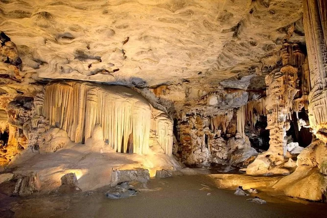
A Valley of Whales in the Middle of Egypt’s Desert

Sunset at Wadi Al Hitan.

The site is so important that scientists argue that site reveals evidence for the history of one of the greatest mysteries in the evolution of whales: the species’ appearance as an ocean-going mammal from a previous life as a land-based animal.

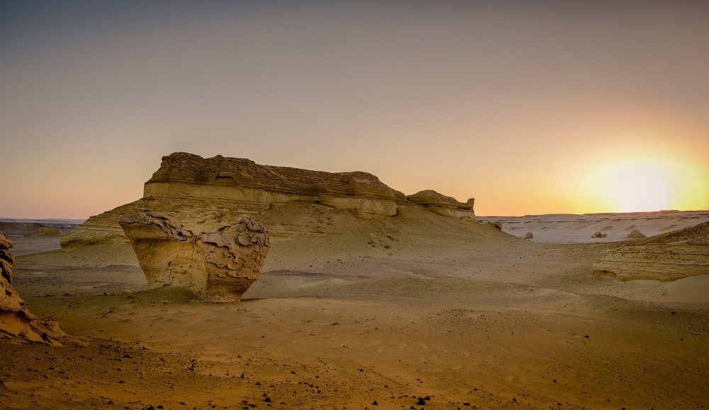
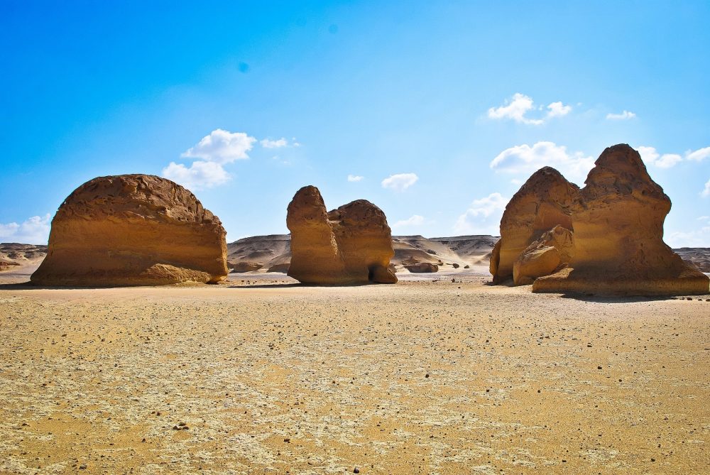
Today, the site is a desert with geological features that make it even more unique. But in the distant past, Wadi Al Hitan was a massive ocean where whales swam, hunted, and reproduced. As the site is dubbed, the Valley of the Whales is the most important site in the world to demonstrate the above-mentioned evolutionary process.

The way of life of these mammals is accurately portrayed during their evolution.  The number, concentration, and quality of fossils are unique to Wadi Al Hitan, a time capsule providing evidence of millions of years of coastal marine life and evolution.

Among the many fossils, researchers have discovered the remains of whales like the Basilosaurus.

These remains show these animals losing their hind limbs and hydrodynamic bodies (like those of modern whales) while presenting primitive bone structure aspects. Other fossil materials found at the site allow the reconstruction of the environment and the ecological conditions of the time. Wadi Al Hitan portrays the form and way of life during the transition from land animals to ocean-going mammals.

The Fossilized remains of Whales at Wadi Al hitan.

Wadi Al Hitan, the Valley of Whales

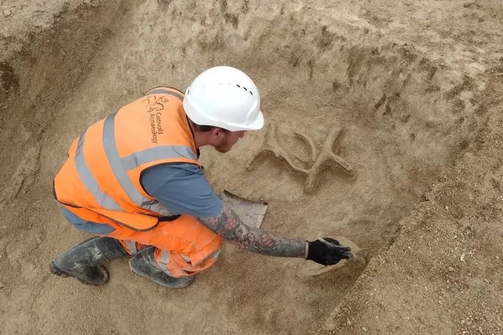
Although the fossils discovered at the site may not be the oldest, their great density in the area and the quality of their preservation is to the degree that even some stomach contents have remained intact. Thanks to the discovery of fossils of other early animals like sharks, crocodiles, sawfish, turtles, and rays, scientists have been able to reconstruct the environmental and ecological conditions of the site accurately.

Some of the geological formations at the Valley of Whales.

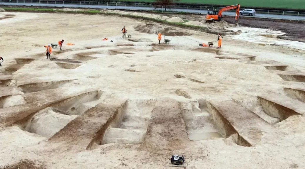
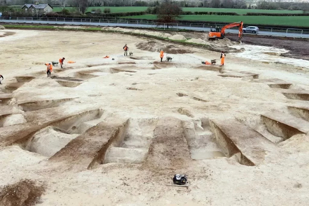
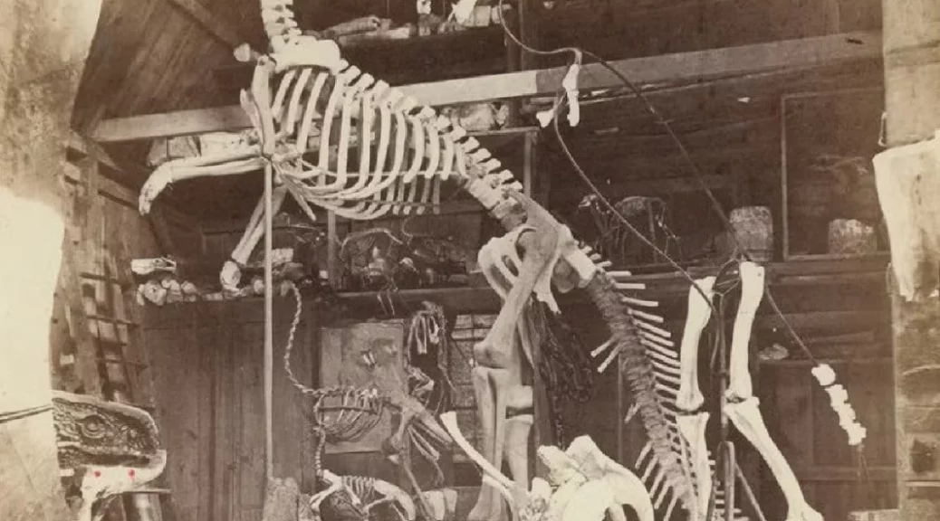
The site and the first fossil skeletons of whales were discovered at the Valley of Whales in 1903. But for over 80 years, the site was forgotten, mostly due to the difficulty of accessing the site.

However, in the late 1980s, as all-wheel-drive- vehicles became widely available, people started visiting and documenting the site. Eventually, the Valley of Whales would attract scholars, fossil collectors, and even tourists. People would go there and collect fossils without properly documenting or conserving the fossils. This led to the disappearance of many fossils from the site, prompting warnings for the site to be adequately conserved.

A Treasure in the Valley of Whales

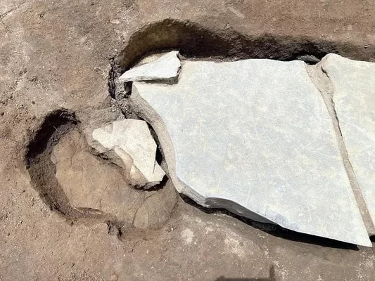
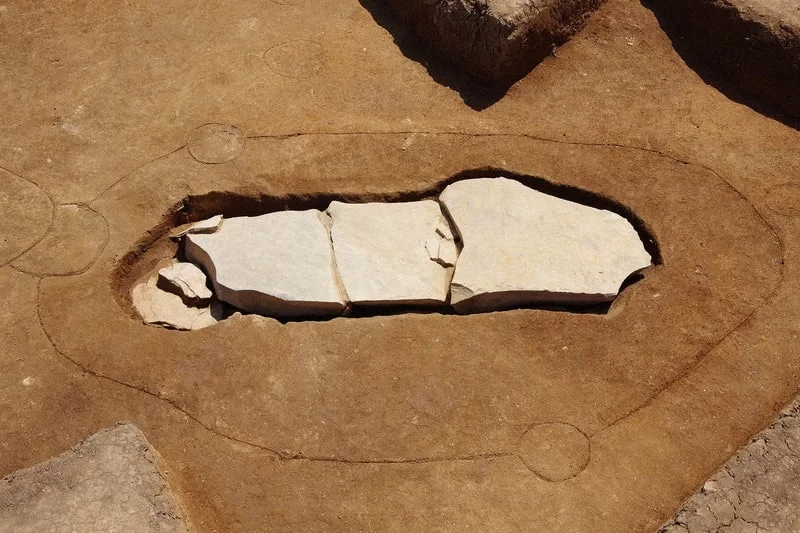
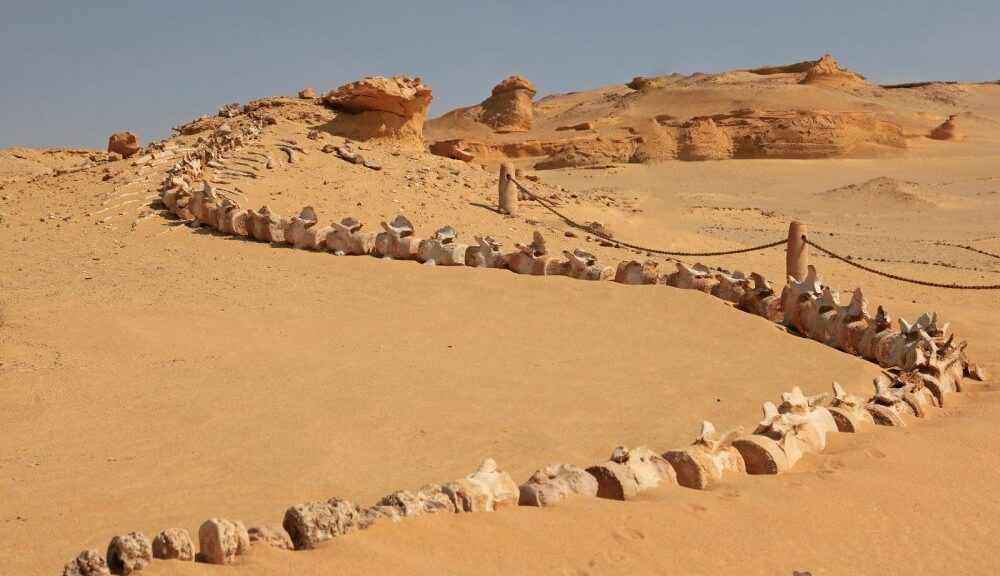
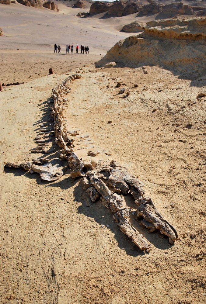
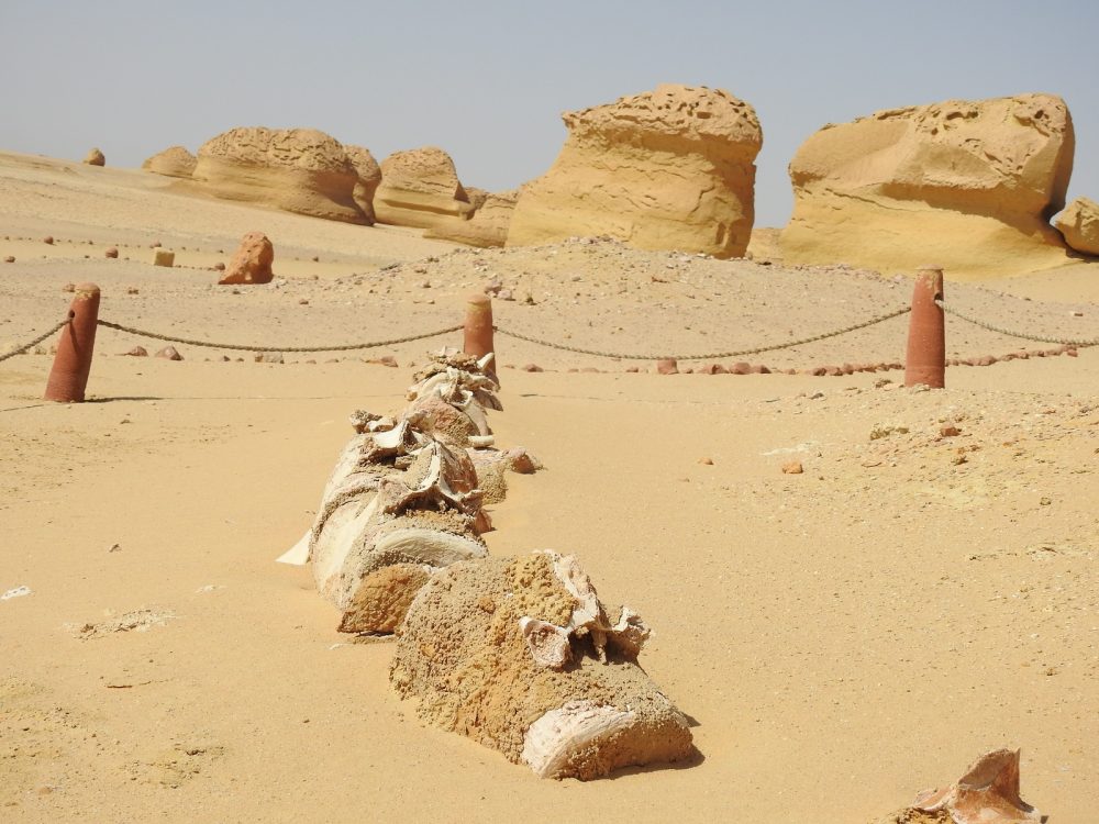
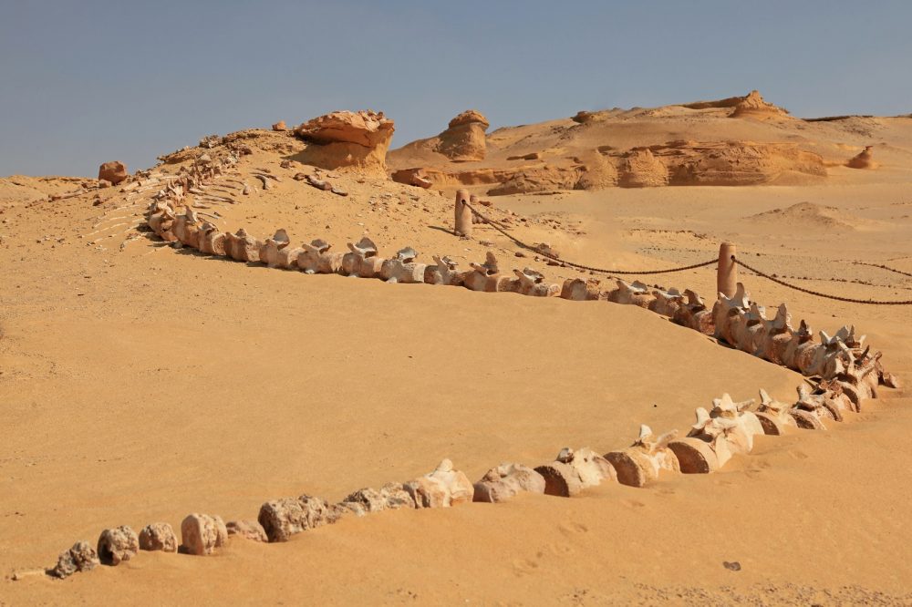
One of the most important discoveries at the site was the largest fossil discovered there, with 21 meters in length. The fossil showed clear traces of five-fingered flippers on its forelimbs and an unexpected existence of hind legs, feet, and toes, precisely unknown features in an archaeoceti. The site exceeds the values of similar sites in terms of the number, concentration, and quality of its fossils and their accessibility, found in an attractive and protected landscape.

The site includes an impressive assemblage of fossilized skeletons of Archaeoceti (primitive whales documenting cetacean transition to marine life), and sirenians. It also includes well-preserved reptile fossils and shark teeth dating back to around 40 million years ago. Scientists have identified the fossils of crocodiles, sea turtles, and the fossilized remains of sea snakes at the site. Many species of bony fish, sharks, and rays are represented at the site, but the largest number of fossils are isolated small teeth, which are often inconspicuous. There are also larger fish fossils, including the rostra and pegs of sawfish. The site features a sawfish rostrum of 1.8 meters long.

Wadi Al Hitan is also home to various fossilized shells and disc-shaped nummulite fossils. According to scientists, the strata in Wadi Al Hitan belong to Middle Eocene, including a vast mass of vertebrate fossils within 200 km2 of the desert. While researchers have identified many whale fossils, they have also cataloged and reported sea cows’ fossils, among over one hundred different fossils.

The Valley of Whales in the Middle of Egypt’s Desert is Millions of Years old

Reconstructing the Origins of Whales

Scientists could reconstruct their origin and conclude their form was serpentine and the animals were carnivorous. The site has been found to feature typical streamlined bodies from modern whales and shows us clear evidence of some of the primitive aspects of skull and tooth structure. In other words, the Valley of Whales in Egypt is a unique site not only because of its diverse fossil library but because of the examples of fossils and their respective age.

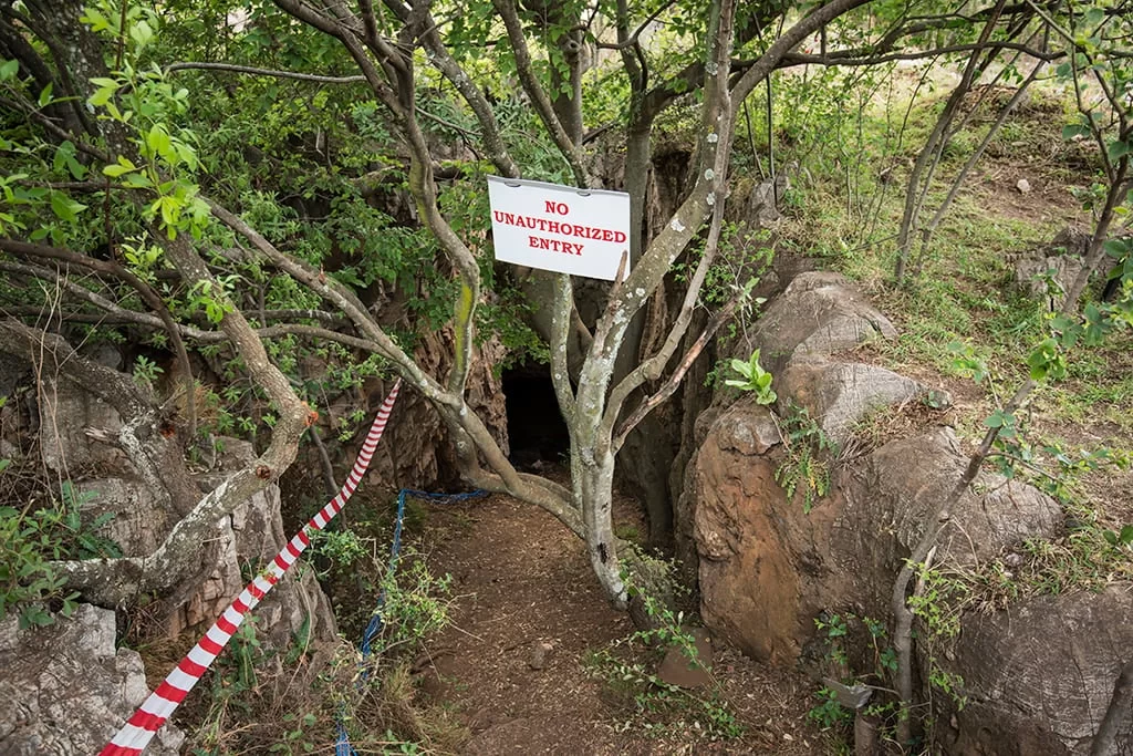
The site has managed to remain well-protected because not many people access it. It is believed that between 1500 and 2000, tourists visited the site, which is accessible through unpaved and unmarked desert roads.

The tourists who decide and come to the site are mostly foreigners who then camp in the valley. Wadi Al Hitan lies within the Wadi El Rayan Protected area, but part of the site has been turned into a tourist venue. There are walkways between the main fossils. Small shelters were also built at the site.

In addition to its vast collection of fossilized remains, Wadi Al Hitan is home to more than 15 different species of desert places and 15 different types of mammals, including the red fox and the Egyptian mongoose. The site is mostly frequented by the Gennec Foxes, who visit the campsite at night searching for food.

Unprecedented drought reveals 7500-year-old Spanish Stonehenge

Unprecedented drought reveals 7500-year-old Spanish Stonehenge

Rising temperatures and drought conditions have caused serious problems for human populations all over the world, according to the World Health Organization.

Those dramatic changes in landscape brought on by lowering water levels, though, have also led to a number of notable discoveries, as Insider notes.

One area particularly affected by drought has been the central Spanish province of Caceres, where water levels in the Valdecanas reservoir have dropped nearly 30%, and as a result, a fascinating site from near pre-history has been recovered, per Reuters. 

Though that lack of water has caused a number of serious problems in the country, the archaeological site that reemerged from the water in Spain dates to around 5,000 B.C., as Reuters also notes.

The site, which up until recently was submerged, was discovered first in the 1920s, but it was lost when the area was flooded for a reservoir project under Franco’s leadership.

The chance to study the area once again is a rare opportunity for scientists, according to Madrid’s Complutense University archaeologist Enrique Cedillo (via Reuters).

THE SPANISH STONEHENGE WAS UNCOVERED

The archaeological site uncovered by the receding waters of Valdecanas reservoir near the city of Huelva consists of dolmens, or large neolithic stone structures, as well as a number of standing stones similar to England’s Stonehenge, according to CNN. For this reason, the area is officially called the Dolmen of Guadalperal, but it’s colloquially known as the  Spanish Stonehenge. In total there are thousands of stones on the site, spread over some 1,500 acres.

What’s also notable about the Iberian complex is that experts estimate there are some 500 stones still standing at the Spanish Stonehenge. According to experts, they were put there at different points in history, beginning as early as 5000 B.C. up through 1000 B.C., as Live Science notes.

There are also coffin-shaped structures on the site called cists where researchers believe human remains were buried.

Similar sites were also likely used as memorials for the dead, but so far, no human remains have been verified.

THE SPANISH STONEHENGE COULD BE OLDER THAN OTHER SITES

A number of similar sites with similar stone structures are found across Europe, according to Britannica, but otherwise not much is known about those who built them.

It’s believed that such areas served a number of purposes for ancient peoples, both ritualistic and astronomic, among other potential explanations. It’s not possible to date the exact age of the stone, but the age of the sediment on the stone can be estimated with radiocarbon dating techniques (via The New York Times).

The sheer number of different types of stones and stone structures at the Spanish complex is particularly notable, and it’s believed to be possibly older than other similar areas so far studied.

Since the Spanish area was spotted in the 1920s and then flooded in the 1960s, it’s only been above water four times. Now that the “Spanish Stonehenge” is once more accessible, some advocate moving it permanently away from the flood area.

The Iberian Peninsula drought that contributed to the resurfacing of the Spanish Stonehenge is the worst of its kind in some 1,200 years. Scientists expect it will worsen, according to CNN. 

Ruins of a 3000-year-old Armenian castle found in Lake Van – Turkey

Ruins of a 3000-year-old Armenian castle found in Lake Van – Turkey

Ruins of a 3000-year-old Armenian castle found in Lake Van – Turkey
Underwater ruins of Armenian castle in lake Van ( Anadolu Ajansı )

A team of Turkish archaeologists has discovered the remains of what is believed to be a 3,000-year-old castle from the Armenian kingdom of Urartu (Ararat) submerged underwater in Lake Van.

The underwater excavations were led by Van Yüzüncü Yıl University and the governorship of Turkey’s eastern Bitlis Province. The castle is said to belong to the Iron Age Armenian civilization also known as the Kingdom of Van, Urartu, Ararat, and Armenia.

The lake itself is believed to have been formed by a crater caused by a volcanic eruption of Mount Nemrut near the province of Van. The current water level of the reservoir is about 150 meters higher than it was during the Iron Age.

“Civilizations living around the lake set up large villages and settlements while the water level of the lake was low, but they had to leave the area after it increased again,”

said Tahsin Ceylan, one of the researchers of the newspaper.

The researchers are expecting to conduct further excavations to reveal the full scale of this discovery. The discovery is expected to attract tourism.

Although now within the borders of the Republic of Turkey, the Lake, and town of Van is the very heartland of Armenian civilization since times immemorial. In fact, so much so, that it is considered the very place where Armenian ethnic identity was first born. According to the records of the 5th-century Armenian historian Movses of Khorene, Hayk (the legendary founder of the Armenian nation) settled near Lake Van in 2492 BC where he first founded the village of Haykashen and build there the mighty fortress of Haykaberd.

At the very shores of Lake, Van Hayk assembled his army and told them that they must defeat the Babylonian tyrant king Bel who had marched against him and his people, or die trying to do so, rather than become his slaves. At Dyutsaznamart (meaning: “Battle of Giants”) near Lake Van, Hayk finally defeated Bel. Hereafter Hayk named the region where the battle took place after his own name and the site of the battle Hayots Dzor (meaning: “Valley of the Armenians”). Thus the Armenian nation and its first free kingdom were born on the very shores of Lake Van after which the Armenians call themselves ‘Hay’ and their country – ‘Hayk’ or ‘Hayastan’, in honor of the legendary founder Hayk.

The ancient Hittite inscriptions deciphered in the 1920s by the Swiss scholar Emil Forrer testify to the existence of a mountain country called ‘Hayasa’ and its vessel lying around Lake Van. The Annals of Mursili (14th century BC) describes the campaigns of Mursili against Hayasa:

And when I arrived in Tiggaramma, the chief cup-bearer Nuvanza and all the noblemen came to meet me at Tiggaramma. I should have marched to Hayasa still, but the chiefs said to me, ‘The season is now far advanced, Sire, Lord! Do not go to Hayasa.’ And I did not go to Hayasa.

Map of historic Armenian with Lake Van at its center. (from Encyclopædia Britannica Online)

It was exactly the works of Movses of Khorene that led to the initial discovery of the Armenian kingdom of Van (Urartu). The existence of this kingdom was unknown to science until the year 1823 when a French scholar, J. Saint-Martin, chanced upon a passage in the ‘History of Armenia’ by Movses of Khorene who had recorded the kingdom in great detail. Inspired by these writings Jean Saint-Martin sent a team to the described location and discovered a kingdom completely unknown to Western academia at the time.

Khorenatsi had described the ancient settlements in Van and attributed them to one of the descendants of Hayk; Ara the Beautiful son of Aram. His description exactly matched, the later discovered, Assyrian clay tablet attributing the foundation of the kingdom to the first king of Urartu; King Aram (c. 860 – 843 BC).

“Urartian history is part of Armenian history, in the same sense that the history of the ancient Britons is part of English history, and that of the Gauls is part of French history. Armenians can legitimately claim, through Urartu, an historical continuity of some 4000 years; their history is among those of the most ancient peoples in the world.”

– Mack Chahin, The Kingdom of Armenia, A History, 1987, revised in 2001

The lake was the center of the Armenian kingdom of Ararat from about 1000 BC, afterward of the Satrapy of Armenia, Kingdom of Greater Armenia, and the Armenian Kingdom of Vaspurakan. Along with Lake Sevan in today’s Armenia and Lake Urmia in today’s Iran, Lake Van was one of the three great lakes of the Armenian Kingdom, referred to as the Seas of Armenia. Its name “Van” is one of the ancient Armenian words for “town” which is still reflected in many Armenian toponyms such as Nakhichevan (meaning: “place/town of descend”), Stepananvan (meaning: “town of Stepan”), Vanadzor (meaning: “valley of Van” ), Sevan, and even the capitol city of Armenia; Yerevan.

Lake Van and its adjacent town also named Van is today part of Turkey, however, its historic Armenian traces are still visible. At the very center of this lake, there is an island called Akhtamar that still holds a thousand-year-old Armenian church; the Cathedral of the Holy Cross.

Armenians lived in Van up until the early 20th century when Armenians were prosecuted by the Ottoman Turks during the Armenian Genocide. One of the last stands of the Armenian people known as the Resistance of Van, where over 55,000 Armenian civilians were massacred by Ottoman militias and bandits, was extensively discussed in newspapers of that time around the world.

The resistance occupies a significant place in Armenian national identity because it symbolizes the Armenians’ will to resist annihilation at the very heartland of the Armenian people.

General view of Akdamar (Akhtamar) Island and the Armenian cathedral of the Holy cross (915 AD).
Medieval Armenian gravestones, Lake Van.
An early 20th century picture of the 10th century Armenian monastery of Narekavank, which once stood near the southeastern shore of the lake.

Scientists discover 4 new Nazca Geoglyphs using AI deep learning

Scientists discover 4 new Nazca Geoglyphs using AI deep learning

Scientists discover 4 new Nazca Geoglyphs using AI deep learning

Scientists from Japan used AI deep learning to discover new geoglyphs in the Arid Peruvian coastal plain, in the northern part of Peru’s Nazca Pampa.

The research has been ongoing since 2004 by a team from Yamagata University, led by Professor Makato Sakai. Yamagata University has been conducting geoglyph distribution surveys using satellite imagery, aerial photography, airborne scanning LiDAR, and drone photography to investigate the vast area of the Nazca Pampa covering more than 390 km2.

The Nazca Lines are thought to have been made over centuries, starting around 100 BC by the Nazca people of modern-day Peru. They were first studied in detail in the 1940s, and by the time they were designated a UNESCO World Heritage Site in 1994, around 30 were identified.

They’re remarkably well-preserved considering their age, helped by the desert’s dry climate and winds that sweep away the sand but are being obscured by floods and human activity.

Archaeologists discovered 142 new designs in the desert over the course of ten years by manually identifying them using aerial photography and on-site surveying. Then, in collaboration with IBM Japan researchers, they used machine learning to search the data for designs that had been missed in previous studies.

Geoglyphs can be categorized into three main types: figurative, geometric, and lineal. (A) “Line-type figurative geoglyphs” were made by removing black stones in a linear pattern exposing the white sand underneath. (B to E) “Relief-type figurative geoglyphs” are often located on slopes and comprise a combination of black stone and white sand surfaces.

In order to create a thorough survey of the area in 2016, the researchers used aerial photography with a ground resolution of 0.1 m per pixel.

The team has identified numerous geoglyphs over time, but because the process takes a long time, they have turned to AI deep learning to analyze the images much more quickly.

A study published in the Journal of Archaeological Science revealed the discovery of four new Nazca geoglyphs using this new method by developing a labelling approach for training data that identifies a similar partial pattern between the known and new geoglyphs.

The four new geoglyphs depict a humanoid figure, a pair of legs, a fish, and a bird.

The humanoid geoglyph is shown holding a club in his/her right hand and measures 5 metres in length. The fish geoglyph, shown with a wide-open mouth measures 19 metres, while the bird geoglyph measures 17 metres and the pair of legs 78 metres.

Four new Nasca geoglyphs identified by Deep Learning. (A) A humanoid, relief-type. (B) A pair of legs, line-type. (C) A fish, relief-type. (D) A bird, line-type. (B to D) are presented to the public for the first time in this paper. Science Direct

“We have developed a DL pipeline that addresses the challenges that frequently arise in the task of archaeological image object detection,” the study’s authors write.

Our method enables the discovery of previously unattainable targets by enabling DL to learn representations of images with better generalization and performance.

Additionally, by speeding up the research process, our approach advances archaeology by introducing a novel paradigm that combines field research and AI, resulting in more effective and efficient investigations.

These results serve as yet another illustration of how machine learning can be useful to scientists, particularly when tackling tasks involving sizable datasets. Just like humans, algorithms can be taught to sift through specific types of data looking for patterns and anomalies.

Although creating these tools can be challenging, once trained, such algorithms are tireless and consistent.

Excavations Near Stonehenge Uncover Bronze Age Barrow Cemetery

Excavations Near Stonehenge Uncover Bronze Age Barrow Cemetery

Excavations Near Stonehenge Uncover Bronze Age Barrow Cemetery

The Cotswold Archeology team excavating at the site of a planned housing development near Salisbury, England, has unearthed a giant barrow cemetery that could be between 3,500 and 4,000 years old.

Wiltshire is well known for its Bronze Age barrows, particularly those found within the World Heritage site of Stonehenge and on the chalklands of Cranborne Chase. In contrast, little is known about similar sites near the medieval city of Salisbury.

These barrows were installed 1,000 years or more after the monuments at Stonehenge were built on the Salisbury Plain just 10 miles (16 km) to the north. The archaeologists discovered enough evidence to conclude that these barrows had been made during the latter period.

However, Vistry’s construction of a new residential housing development on the outskirts of Harnham, a southern Salisbury suburb, has provided the opportunity to unearth some of the remains of a major round barrow cemetery and its landscape setting.

Round barrows were first constructed in the Neolithic period, although most were built during the Beaker and Early Bronze Age (2400 – 1500 BC), and usually consist of a central burial, a mound, and an enclosing ditch.

View of the barrows under excavation.

The size of round barrows can range from under 10 meters in diameter to up to 50 meters, although the majority tend to average between 20 and 30 meters. Additionally, the earthworks associated with barrows can vary.

Some have large central mounds (‘bell barrows’), others small central mounds and outer banks (‘disc barrows’), and some have central hollows (‘pond barrows’).

Their ditches would have provided material for the barrow mound, which would have been constructed of chalk, topsoil, and turf. Barrows are typically associated with burials; some contain only a single individual, while others contain a series of burials and, on rare occasions, multiple burials.

“Our cemetery is made up of about twenty or more barrows that spread from the very edge of Harnham on the Nadder valley floor, up and across the adjacent chalk hillside on what is the northern edge of the landscape of Cranborne Chase,” the Netherhampton site discoverers wrote in a Cotswold Archaeology press release. 

“The cemetery is arranged in small clusters of barrows—either pairs or groups of six or so—and we’ve so far excavated just five.”

The Cotswold archaeologists have discovered 10 burials as well as three piles of buried cremation ash inside the five ditches they have already excavated.

A further indication of how well-liked this burial ground must have been with the people who lived in the area around Salisbury 4,000 years ago and beyond are the signs that two of the site’s barrows have undergone significant expansion at some point.

Excavations also uncovered Saxon remains, including a possible sunken-featured building, preserved timbers, iron knife blades, and ceramics, as well as a cultivation terrace (‘lynchet’) of probable late Iron Age date and Bronze and Iron Age pits.

Paleontologists say the world’s oldest-known burial site was found in South Africa

Paleontologists say the world’s oldest-known burial site was found in South Africa

Paleontologists say the world’s oldest-known burial site was found in South Africa

American explorer and scientist Lee Berger in South Africa said they have found the oldest-known burial site in the world, containing remains of a small-brained distant relative of humans previously thought incapable of complex behavior.

However, the scientist announced the discovery of a non-human species that uses symbols to mark their dead.

The researcher announced on Monday that he had evidence that Homo Naledi, a species with a brain the size of a chimpanzee, buried its dead and painted symbols on the walls of the tombs between 200,000 and 300,000 BC.

Researchers said they found the discovery buried about 30 meters (100 feet) below ground in a cave system at the Cradle of Humanity, a UNESCO world heritage site near Johannesburg.

“These are the most ancient interments yet recorded in the hominin record, earlier than evidence of Homo sapiens interments by at least 100,000 years,” the scientists wrote in a series of preprint papers, yet to be peer-reviewed, to be published in Life.

Paleontologist Lee Berger .

The findings cast doubt on the conventional wisdom regarding human evolution, which holds that the growth of larger brains enabled the performance of complex, “meaning-making” activities like burying the dead.

The oldest burials previously unearthed, found in the Middle East and Africa, contained the remains of Homo sapiens — and were around 100,000 years old.

“We are going to tell the world that we have discovered a non-human species, that had fire and controlled it, and went into incredibly difficult-to-reach spaces, and buried its dead in a ritual fashion, over and over and over again. And while they were doing that, they carved symbols on the wall above it”, said paleontologist Lee Berger.

Some experts however remain “sceptical” of his theory and require exceptional evidence to validate Berger’s claims.

Rising Star Cave.

In 2013, Lee Berger discovered the richest deposit of hominid fossils in Africa and introduced the world to Homo Naledi.

This species discovered by Dr. Berger had already upended the notion that our evolutionary path was a straight line, with curved fingers and toes, tool-wielding hands, and walking feet. Homo naledi is named after the “Rising Star” cave system where the first bones were found.

The holes, which researchers say evidence suggests were deliberately dug and then filled in to cover the bodies, contain at least five individuals. The oval-shaped interments at the center of the new studies were also found there during excavations started in 2018.

“That would mean not only are humans not unique in the development of symbolic practices, but may not have even invented such behaviours,” Berger told AFP in an interview.

The burial site is not the only sign that Homo naledi was capable of complex emotional and cognitive behavior, engravings forming geometrical shapes, including a “rough hashtag figure”, were also found on the apparently purposely smoothed surfaces of a cave pillar nearby.

New suspect in the greatest act of vandalism in the history of dinosaur study

New suspect in the greatest act of vandalism in the history of dinosaur study

New suspect in the greatest act of vandalism in the history of dinosaur study

Researchers from the University of Bristol are rewriting the history of paleontology’s darkest and most bizarre event.

Vandals with sledgehammers destroyed skeletons and models intended for display in New York’s first dinosaur museum before it was even finished in 1871.

For more than a century, historians believed William “Boss” Tweed, New York’s most powerful political figure at the time, was to blame. But now researchers have revisited the crime — and point to a new suspect in what they call the “greatest act of vandalism in the history of dinosaur study.”

However, a recent paper by Victoria Coules of Bristol’s Department of History of Art and Professor Michael Benton of Bristol’s School of Earth Sciences sheds new light on the incident and, in contrast to earlier accounts, identifies who was actually behind the order and what drove them to such wanton destruction—an odd man by the name of Henry Hilton, the Treasurer and VP of Central Park.

Paleontology was still in its infancy in 1871, and new discoveries made all over the world stoked curiosity about the enormous extinct animals. The Paleozoic Museum was to feature the work of Benjamin Waterhouse Hawkins, an English natural history artist who galvanized interest in dinosaurs in the United States with the display of the world’s first mounted dinosaur skeleton in Philadelphia in 1868.

Benjamin Waterhouse Hawkin’s conceptual drawing of the Paleozoic Museum. Photo: Annual report of the Board of Commissioners of Central Park (1858)

Hawkins used fossil evidence to create full-sized models for elaborate dioramas in preparation for the New York Museum. However, the museum was canceled in 1870 by the Tweed-controlled Central Park board. Vandals destroyed all of Hawkins’ models, casts, and studio a few months later.

“It’s all to do with the struggle for control of New York City in the years following the American Civil War (1861-1865),” said Victoria Coules. “The city was at the center of a power struggle—a battle for control of the city’s finances and lucrative building and development contracts.”

As the city grew, the iconic Central Park was taking shape. More than just a green space, it was to have other attractions, including the Paleozoic Museum.

Professor Benton explains, “Previous accounts of the incident had always reported that this was done under the personal instruction of ‘Boss’ Tweed himself, for various motives from raging that the display would be blasphemous, to vengeance for a perceived criticism of him in a New York Times report of the project’s cancelation.”

A, William “Boss” Tweed (1823–1878). Photo: Wikipedia

“Reading these reports, something didn’t look right,” Coules said. “At the time Tweed was fighting for his political life, already accused of corruption and financial wrong-doings, so why was he so involved in a museum project?” She added, “So we went back to the original sources and found that it wasn’t Tweed—and the motive was not blasphemy or hurt vanity.”

The American Museum of Natural History (AMNH) and the Central Park Zoo were two additional projects in Central Park that were simultaneously under construction, which complicated the situation. But, as Professor Benton explained, “drawing on the detailed annual reports and minutes of Central Park, along with reports in the New York Times, we can show that the real villain was one strange character by the name of Henry Hilton.”

Coules adds, “Because all the primary sources are now available online, we could study them in detail—and we could show that the destruction was ordered in a meeting by the real culprit, Henry Hilton, the Treasurer and VP of Central Park—and it was carried out the day after this meeting.”

C, Henry Hilton (1824–1899). Photo: Wikipedia

Professor Benton concluded, “This might seem like a local act of thuggery but correcting the record is hugely important in our understanding of the history of paleontology. We show it wasn’t blasphemy or an act of petty vengeance by William Tweed, but the act of a very strange individual who made equally bizarre decisions about how artifacts should be treated—painting statues or whale skeletons white and destroying the museum models. He can be seen as the villain of the piece but as a character, Hilton remains an enigmatic mystery.”

Hilton was already notorious for other eccentric decisions. When he noticed a bronze statue in the Park, he ordered it painted white, and when a whale skeleton was donated to the American Museum of Natural History, he had that painted white as well. Later in life, other ill-judged decisions included cheating a widow out of her inheritance, squandering a huge fortune, and trashing businesses and livelihoods along the way.

The largest stone coffin grave found so far at the Yoshinogari Ruins -3.2 meters in Japan

The largest stone coffin grave found so far at the Yoshinogari Ruins -3.2 meters in Japan

A grave with a stone coffin around 2.3 meters long and dating to the latter part of the Yayoi Period was unearthed in Saga Prefecture, northwest of Kyushu, in southwesternmost of Japan’s main islands.

It is the largest stone coffin grave found so far at the Yoshinogari Ruins.

It is believed the grave was created between the latter half of the second century and the mid-third century when the Yamatai state existed.

According to the Saga Province prefectural government announcement, the discovered sarcophagus has four stone lids and a maximum length of 2.3 meters, and a width of 0.65 meters.

The grave measures about 3.2 meters. It is around 1.5 times the diameter of a typical grave pit for stone coffin graves that have previously been unearthed at the site.

The largest stone coffin grave found so far at the Yoshinogari Ruins -3.2 meters in Japan

The surface markings, which are thought to have been etched with sharp metal tools, closely resemble an “x” or the Japanese katakana symbol for “ki.” These shapes are thought to have the ability to protect a buried person from evil.

The governor’s office believes an influential person was buried there because it is located on top of a hill with a magnificent view.

The prefectural government plans to open the coffin on June 5.

The largest ruin among all the Yayoi ruins excavated in Japan, Yoshinogari spreads throughout the Kanzaki area of Saga Prefecture (Kanzaki town, Mitagawa town, and Higashisefuri village).

The Yayoi period was a long era spanning approximately 700 years. In the late Yayoi period, Yoshinogari developed into the largest moated village in the country, encircled by a large outer moat dug down in a “V” shape.

The village also came to feature two special inner areas (the “Northern Inner Enclosure” and the “Southern Inner Enclosure”). Particularly in the Northern Inner Enclosure, large buildings appeared as Yoshinogari entered its golden age.

All In One Magazine